
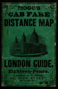
Mogg's Cab Fare Distance Map and London Guide.: Index to the Streets, Squares, and Cab Stands.
Written by Edward S. Mogg
Not rated yet — tap a star to review it
Chaptra reads alongside you — AI insights, chapter breakdowns and reader discussions for every book. Join free
About this book
"Mogg's Cab Fare Distance Map and London Guide" by Edward S. Mogg is a practical guidebook written in the mid-19th century. The book serves as an extensive reference for navigating London, featuring detailed fare information, a distance map, and an index of three thousand locations throughout the city. It is likely aimed at both locals and visitors, helping them to easily find their way around the bustling metropolis and understand the cab fare system. The opening portion of the guide introduces the structure of the book, emphasizing its usability through an index that corresponds places with a grid system on the accompanying map. It explains the method for locating streets, squares, and cab stands, making it easier for readers to navigate the streets of London efficiently. The first few pages contain various entries that are systematically organized, illustrating the comprehensive nature of the guide and indicating its focus on practical navigation rather than storytelling or character development.
Reading guide
Themes, characters and key ideas in Mogg's Cab Fare Distance Map and London Guide.: Index to the Streets, Squares, and Cab Stands., written by Chaptra AI.
A reading guide for this book hasn't been written yet. Chaptra builds one the first time a reader opens it.
Chapter-by-chapter breakdowns, character arcs and the full thematic analysis come with a free account.
Discussions
No one has started one yet
No discussions yet
Be the first to start a discussion about this book!
Sign up to start the discussionReviews
No reviews yet
Be the first to review this book!